Parkhouse Hill - Peak District Walk
Friday 7th May 2010
I was joined today by fellow OFC member Angela and her dog Bailey who were holidaying in the Peak District. Angela had recently commented on the OFC board that she fancies walking around the Earl Sterndale area again and as I hadn't visited it for a couple of years I thought it was about time I returned there as well. Parkhouse Hill has been on my to do list for some time now, but as it has a very narrow ridge it's a hill I have never fancied doing on my own. Angela was more than happy to venture over the narrow ridge, so we had the first part of the route sorted.
Start: Earl Sterndale (SK 0903 6703)
Route: Earl Sterndale - Hitter Hill - Parkhouse Hill - Chrome Hill - High Edge - Dowel Dale - Earl Sterndale
Distance: 5.75 miles Ascent: 418 metres Time Taken: 4 hours 25 mins
Terrain: Generally good paths but narrow ridges, with some scrambling, on two of the hills.
Weather: Dry and warm when the sun was out but cold and windy when it wasn't.
Pub Visited: None Ale Drunk: None
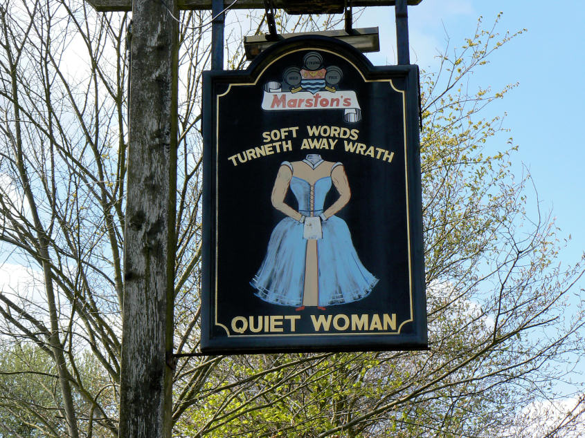
The walk starts opposite the infamous Quiet Woman pub. The sign is thought to depict a nagging wife known as Chattering Charteris whose husband, the pub landlord, lost control one day and cut off her head, to the approval of the villagers.

Looking back to Earl Sterndale from the path to Hitter Hill.

The view across to the pointed Hind Low, from Hitter Hill.

Over the brow of Hitter Hill and the main two objectives of the day come into view, Parkhouse Hill and Chrome Hill.

Approaching Parkhouse Hill, the climb up it was every bit as steep as it looks.

Getting close to the summit of Parkhouse Hill and this is the widest bit of the summit ridge. It was also at this point that the wind decided to pick up and blow some strong gusts our way.

Angela's dog Bailey isn't too sure about posing on Parkhouse Hill's summit.

The view of the Upper Dove Valley from Parkhouse Hill.

Looking towards Dowel Dale and Upper Edge, which we would cross later in the walk.

The view down Parkhouse Hill's ridge from the summit.

Safely down the ridge and approaching Sugarloaf.

Chrome Hill from the lower slopes of Parkhouse Hill.

In reverse, Parkhouse Hill from Chrome Hill.

The view back along the lower ridge of Chrome Hill to Parkhouse Hill, taken from the stile on Chrome Hill.

The same view from higher up Chrome Hill.

Looking along the Upper Dove Valley from Chrome Hill's summit.

In the opposite direction the view extends as far as Axe Edge and includes Hollins Hill and High Edge.

Bailey poses in the natural arch, which isn't far from Chrome Hill's summit.

A small section of limestone pavement as we follow the path across High Edge.

Looking back to High Edge's summit. It now appears that you can get to the summit but we didn't bother as the farmer was busy checking on his newborn lambs and might not have taken too kindly to Bailey barking at his quad bike, even though he was on his lead.
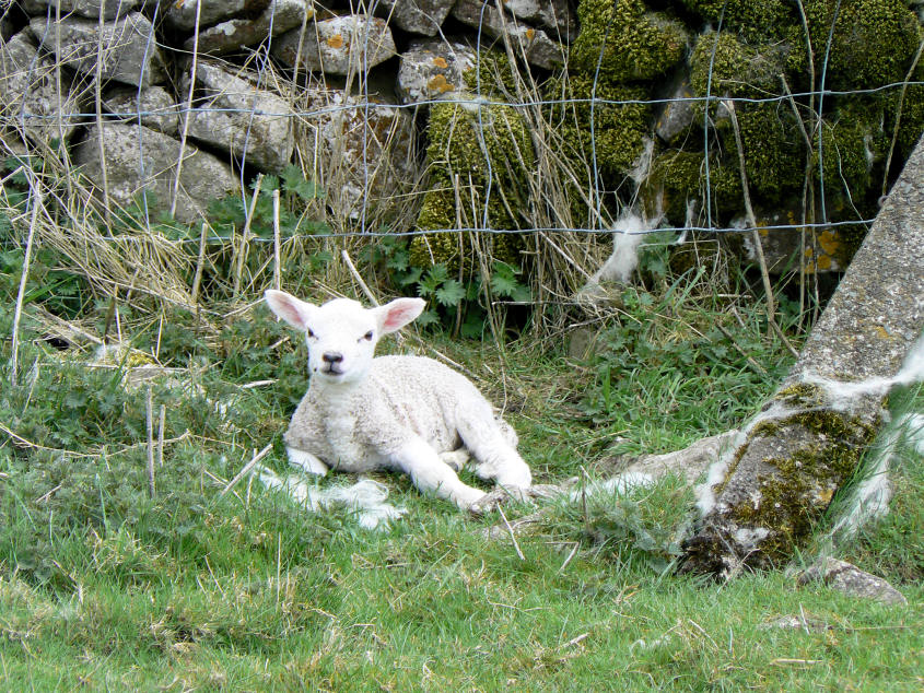
As we approached Greensides farm we came across this tiny lamb sat by the stile. He/she didn't move even as we crossed the stile, which is right next to him/her. Even stranger, there was no sign of mum.

Looking back to High Edge.

Dowel Dale.

Looking down on Dowel Dale from Upper Edge.

You get a good view of the cliffs on Parkhouse Hill from Upper Edge.

Hitter Hill and High Wheeldon.

St Michael's church in Earl Sterndale. The only church in Derbyshire to be hit by a German bomb during the Second World War.
All pictures copyright © Peak Walker 2006-2023